 Linda and I have lived with technology at a professional level for decades and its interesting to note that nowadays we find that the go-to device 99% of the time is our Smartphone. For everything from an alarm clock to email and photos to recipes. Consider too that smart phones (and most tablets) combine many technologies into one device (GPS for example) and become exponentially more useful because of it. Our laptops remain in their bag for all but the most grueling of tasks (like those that require a lot of typing) because just about everything else is way easier and faster to do with our little pocket sized helpers.
Below are listed a few apps that are not necessarily travel or RV related but nevertheless are some of the most functional apps that we use while on the road (and water), maybe there is something here that would be useful to you too! Our devices are Android based but more likely than not, similar apps are also available for the iPhone (IOS) as well as some of the other phone operating systems. All of these apps are free unless other wise noted.
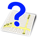
Where Am I? – the name pretty much says it all, this very simple to use app comes in handy often for travelers. Just fire it up and within a few seconds you know Zip Code, City, Street, County, State, Country, Area Code, Sunset, Sunrise and of course Lat/Lon – for the exact location you are standing (or sitting, or whatever). It even includes a map image. When arriving at a new campground this app is usually the fastest way to determine the local Zip Code for configuring our DVR for the local over the air (OTA) TV channel lineup.
Update 9/2020 – the following two apps, Bubble and Compass are no longer available. However, we we have switched to the Compass, Level & GPS app which is even better because it combines the leveling function of Bubble with a nicely done Compass, plus location info.
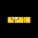 Bubble (no longer available, link goes to the Compass Level & GPS app) – a super simple level. We use this often to level the coach when we put down the jacks. Put the phone flat and Bubble displays – you guessed it – a 360 degree bubble level, hold it sideways or upright and it displays a linear carpenter’s style level. I like to have the front end of the coach just slightly elevated so any rainwater runs off the rear gutters and the 360 bubble is great for that – I simply place it on my favorite floor tile at the center of the coach. This app can also be set to emit an audible acknowledgement when you have reached level. Sweet! Note – you may need to calibrate your phone with a real level before use.
 Compass (no longer available, link goes to the Compass Level & GPS app) – sometimes I just get confused, what can I say? (Ask Linda). This helps me get back on track – quick and easy.
Update 9/2020 – the following app, TV Antenna Helper Free are no longer available. That is just as well, as it didn’t work properly with newer Samsung phones. We have switch to the DTV Antennas app which is even easier to use and also provides the RF Channel information.
 TV Antenna Helper Free (no longer available, link goes to the DTV Antennas app) – this app is most useful for those of us that are too cheap to pay for a satellite subscription and primarily watch free High Def OTA (Over-the-Air) TV. Upon startup it will detect your location via GPS, then allow you to download a directory of the local TV transmitters relative to where you are. You can view them in a color coded list indicating relative strength, or on a map indicating relative direction, or on a compass so you can directly point your antenna towards the strongest grouping of transmitters. Now when you run a channel scan on your TV you are likely to get more channels, or at least the ones you want! An additional feature of this app and one that we use often, is the ability to display the true “RF Channel” of a station (you must enable this option in settings). The channel a TV station calls itself publicly is almost always different than its true RF channel. For example NBC channel 10-1 in Providence, RI has an RF channel of 51. Why would you want to know this? If you have an antenna amp like the Winegard SensarPro it only displays stations it detects by their true RF channel number – this could be meaningless info unless you have some way to easily cross reference the RF channel to the network ID (ABC, CBS, NBC, PBS, etc.). Antenna Helper provides the cross reference so you can then use the SensarPro to very precisely aim and tune the antenna for maximum reception of a particular station you want.
Update 9/2020 – we no longer recommend the following app, Pro Weather Alert. It seems to not be maintained any longer. We have switched to a dedicated weather radio that has a travel mode (it always searches for the strongest signal). This is partly because severe weather can take out a cell phone towner rendering a weather app unreliable.
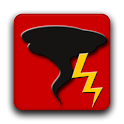 Pro Weather Alert ($1.99) – this app is the smartphone equivalent of a weather alert radio and one of the few apps we have purchased. While standard weather apps (like Weather Bug) are great for getting a forecast and looking at the radar, they require us to initiate the action – if we don’t think to do it, nothin’ happens! Weather Alert on the other hand will proactively “push” alerts to our phone and warn us immediately and persistently of any Urgent, Emergency or several other levels of warnings for the location where we are. Things that scare us the most are Tornados and other fast moving severe weather and if there are any around we want to know about it! The PRO version allows much more flexibility in configuring the actions of the assorted alert levels, provides the ability to filter alert types and also allows unlimited watch locations. This app does take a little effort to configure the way you want it and it can get annoying warning you of lesser alerts if you don’t take the time to set it up properly. Also we are careful not to totally depend on this app for emergency warnings and also carry a dedicated weather alert radio on the coach.
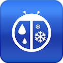 Weather Bug – Just a good free weather app. We use it for the forecast of course and for the real time weather radar. You can add as many locations as you like so you can see the weather along your route. This app can also send some warning and watch alerts to your Android notification tray but it is not persistent about notifying you of them like Pro Weather Alert. Another cool new feature is the “Spark” lightning detector which will show you in real time how far away you are from any lightning strikes!
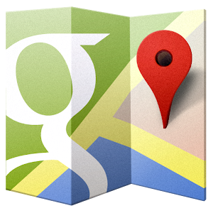
Google Maps – Probably our most used app whether in the car, the coach, the boat, the bikes or just walking around. We usually find it to be significantly easier and way faster to search for a destination (e.g. Wal-Mart, breakfast joints, campgrounds, etc.) using Maps vs. browsing to the vendor web site. In addition to the traditional road map info, this app also includes integrated sub-apps. There are several of these, but the functions we use most often are:
- Services will show you places that are nearby to your approximate location at any given point in time. Eat, Drink, Play, Shop, Sleep, etc. – anything you can search for. Once you find what you need, tap the pin and get Directions or Navigate to it! This info is online and typically a lot more up to date vs. the months or years old static “POI” data typical of a dedicated (and offline) GPS or guidebook.
- My Places allows you to “star” someplace you’ve been like a restaurant, campground or whatever. All your starred places are permanently stored in your Google account so you will have an on-the-map record of all your favorite spots. These will display anytime you are logged into your Goggle account on any device, not just your smartphone.
- Navigation is, at its minimum, the equivalent of a dedicated vehicle GPS and will guide you to your destination with spoken voice prompts, whether it be by car, public transportation, bicycle or foot. However, Navigate can do things an ordinary GPS cannot. For example, you can elect to see the road map data superimposed on a satellite or topographic imagery “Layer”. A Traffic “Layer” can also be shown with easy to see color coded roadway status – we have found it to be the most accurate of all the traffic services we have tried (and it’s free!). Then there is Street View which will give you a street level view of most areas – you can move and look around in any direction, even straight up and down! This is great for checking out that intersection or roadway to see if it is big rig friendly. I also like when navigating a route, that the time to a destination is based on the actual real-time traffic data and that you can choose from multiple alternate routes. In larger cities, Transit Data allows you to follow a walking route complete with subway/bus stops and times! We have used this in Boston several times – it beats trying to figure out the subway map! There is so much more to this incredibly powerful app too! Its worthwhile to spend some time with it and learn how to use it. Note however that we don’t exclusively depend on Navigate for plotting our route in the coach, because it does not yet support RV routing parameters (height, length, weight, etc). We typically run it simultaneously with our dedicated RV capable GPS – when the two disagree we stop and investigate (and more often than not Google has the better info). Be aware that Navigate could download a good sized chunk of data on a long trip, so watch your usage if you are not on an unlimited data plan. Hint; when navigating a route turn off the satellite imagery, this will greatly reduce the amount of data downloaded. For you techies, a “pre-cache” feature is available that would allow you to preload the map data (like while you are on free WiFi) and minimize plan data usage.
 WiFi Analyzer – Helps you visualize the assorted WiFi networks around you and shows their relative signal strength in real time. Also provides the channel numbers used by each access point – this is helpful for example when configuring your own on-board WiFi equipment and you want to choose a channel that is not in conflict with other nearby WiFi networks.

Fing Network Tools – definitely a geek level app, but thought I would mention it as it is a great tool for checking out your network setup. You can see all the devices on your network by IP and MAC addresses (is there someone connected that shouldn’t be?) and then dig deeper and see for each device what ports are broadcasting services, etc. Typical troubleshooting tools like ping and trace route are included as well.
Update 9/2020 – the following app is still a good app, but we don’t use it much anymore. We have switched to the Wyze line of cameras (sophisticated, yet very inexpensive) and have switched to the easy to use Wyze app. We are also using the Wyze plug, Wyze Sense, Wyze Scale and Wyze band.
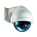 IP Cam Viewer PRO ($3.99) – Our coach has its own internet connection provided by a Millenicom MiFi device that has a relatively low cost high volume data plan (20GB for $70/mo) on the Verizon 4G LTE network. If you were to purchase 20GB directly from Verizon on their Share Everything plan it would cost at least $150/mo. We connect to the Millenicom MiFI with our smartphones while we are on or near the coach (they automatically connect to it via WiFi) and keep a small data plan on the smartphones themselves so we have internet access when away from the coach (for us typically 2GB shared by both our phones is plenty). The Millenicom MiFi is also connected to our laptop’s, DVR’s, Satellite, Blue Ray, TV’s, Roku and other devices that occasionally need web access. We also have a wireless IP Camera on board so we can keep an eye on the kitties and other goings on around the coach when we aren’t there. An IP Camera is a completely standalone device with its own built in web server, so using IP Cam Viewer, we can connect to the coach camera from just about anywhere! The camera we are using (Foscam) is a Pan and Tilt model so we can point it in any direction – even to look outside since it is mounted near the front windshield. (Panasonic also makes a good line of reasonably priced IP Camera’s). We also used to have a bank of surveillance cameras at our house (that has now been sold) that we could see with this app. While our use of IP Cam Viewer is somewhat specific to other equipment we have on board, it could still be useful to you too as it also supports traffic cameras allowing you to get a real time look at the roadway before you head into those typically congested areas. Cam Viewer Light is the free version that disables some advanced features available with various IP Cameras, but it may be just perfect for you. This app is very well supported and frequently updated – highly recommended.
 RVParky – I had intended to refrain from listing “ordinary” RV/Travel apps that you probably already know about or have been listed elsewhere, but I just discovered this one and felt it was worth a mention. RVParky is a free app that will show RV Parks, Rest Areas, Parking Lots and Gas Stations on a zoomable map (just like Google Maps) complete with Satellite and Topo options. Tap on a marker and a pop-up comes up and shows you services for that location – for example all the services a campground offers including things like 50A, Big Rig Friendly,Pull Thru’s, etc. Tap on the pop-up for more info, including (usually) a button to call the campground, direct links to the campground website and a link to search the web for online reviews of the campground (such as rvparkreviews.com). This is my favorite feature and what makes this app so useful to me – from one central place I can easily visualize the geography of a location and get direct links to all the info I need. It is one of my most heavily used apps these days. Is it perfect? Probably not, but the list of locations seems to be fairly comprehensive and you can’t beat the price! Seems to be updated frequently. A different app, Allstays Camp & RV Campground Plus, provides similar capabilities and claims to have more complete data but it costs $9.99.
Hope you find some of these apps to be useful for your travels. Feel free to Leave a Reply below and share with us any cool apps that you have discovered that make your nomadic life easier!
Related

Well, and I thought I was a “techie”, I guess not! Thanks for the neat apps!
Byron